
Customer story — FarmDefender™

The rock you don't find at seeding
goes through your combine at harvest.

Colin Rosengren runs a grain operation out of Saskatchewan. Nine AI depth cameras ride his 84-foot air seeder — not to protect the drill, but to map every rock in the field while he's already covering the acre. The map goes to a phone. Anyone on the farm can then drive to each pin and pick the rock, months before the combine ever gets there. The system shipped May 2026.

0 pass
Full-field rock map
The seeding pass — no extra trip across the field
0
Depth cameras
Stereo AI vision, full boom coverage
0cm+
Detection threshold
Every rock big enough to wreck a combine, pinned

The challenge

Rocks are a harvest problem. A rock that stays in the field all season eventually gets fed into a combine, and that's where the real bill comes due — a damaged concave, a plugged feeder house, a machine down in the narrowest window of the year, with the crop standing and the weather moving.

Picking rocks isn't the hard part. Finding them is. Colin had done what every experienced producer does: walked fields, scouted, sent crews out. It's slow, it costs labor at the busiest time of year, and it doesn't catch what's sitting between the passes you happened to walk.

Meanwhile the seeder already covers every acre of every field, once a year, at the exact time of season when there's still time to do something about what's out there. Nobody was capturing it.

The solution

FarmDefender turns that seeding pass into the survey. Nine stereo depth cameras sit across the full 84-foot bar. Each one runs an AI model in real time — not a blob-detector, not edge detection, but a trained neural network that classifies rocks and returns a confidence score, position, and depth estimate for every object above the detection threshold.

Detection starts at 6 cm. Every detection is logged with GPS position and depth estimate as the seeder rolls. Colin isn't steering around anything and the drill isn't stopping — the map is simply building itself underneath a pass he was making regardless.

The system mounts to Colin's existing bar. Single PoE cable run to the cab. No proprietary terminal required. FarmIQ™ gets the detection log automatically — rock maps become field history that doesn't reset at season end.

The math

The rock you pick in May is the combine repair you don't pay for in September.

Colin runs the system because the old method — human scouting, repeat field walks, hoping — was already costing real labor at the busiest time of year, and it still left rocks in the field.

Rock damage at harvest is the expensive kind: parts and labor on a machine that costs more than the drill, plus downtime measured against a standing crop and a closing weather window. Picking the same rock in spring costs a side-by-side and twenty minutes.

The detection map doesn't reduce the number of rocks in the field. It changes which season you deal with them in.
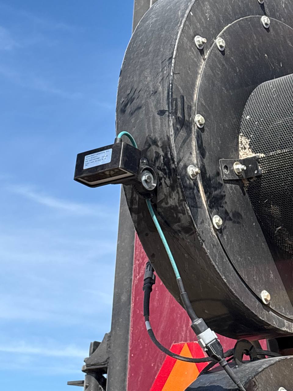
FD-84D depth unit FarmDefender FD-84D depth-camera unit mounted on an air seeder in Saskatchewan

From seeding pass to picked rock

1 — Seed the field

Nothing changes about the pass. The operator seeds. The cameras detect and georeference every rock ≥6 cm the bar crosses, and the map builds itself in the background.

2 — Open the map on a phone

The rock map lands in FarmIQ. Anyone with the login — a hired hand, a family member, whoever has the afternoon — pulls it up on a phone. A compass arrow and a live distance readout walk them onto the next rock. No terminal, no office computer, no GIS software.

3 — Pick it before harvest

Pick the rock, mark it picked. It clears off the map for everyone on the account, so two people can work the same field without picking the same rock twice — and that rock never reaches the combine.

What deployed

FD-84D rock detection

Nine stereo depth cameras across an 84-foot bar. Full coverage at operating speed. Every rock ≥6 cm detected, classified, and georeferenced as the seeder passes over it.

FarmIQ integration

Detection events log to FarmIQ automatically — the same platform FarmTech has run customer field data on for years. Rock maps accumulate season over season, so you learn which zones keep producing rocks instead of rediscovering them every spring.

No change to the operation

Mounts to the existing bar. One PoE run to the cab. No proprietary terminal, no second pass, no slowing down for the cameras. The seeding job is unchanged — it just produces a rock map now.

How does your operation handle rocks?

If the answer involves crew time, repeat field walks, or finding out at harvest — we can give you a straight number on what mapping costs versus what a rock through the combine costs.